I just came across a really nice part of the BBC web site for Cardiff called Streets of Cardiff. It allows anyone to upload (moderated, this is the BBC!) stories, pictures, or videos about different areas and these are presented as points on a map. Below is the Roath Park and Penylan page … where I grew up:
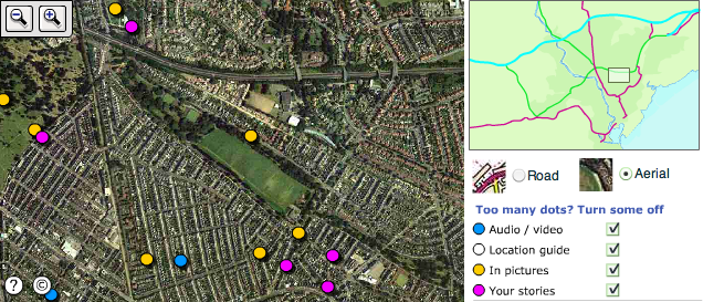
[ screen shot ] [ BBC web page ]
Given it is the BBC no google mashup, but a little flash app! But a very nice bit of webbery, community content etc. … pity they don’t have it for everywhere. For years now I have kept thinking it would be really nice to have a coherent location-based portal of everywhere and even got a domain for it! Whilst google maps and related things are getting close to that dream, still it is hard to find things by location … maybe one day …
This also reminded me of some pictures of Roath Park I took a short while back for a keynote I gave a few years ago “Paths and Patches – patterns of geonosy and gnosis“, so I have just added them as a Roath Park flickr set.
… and now I really must get back to work.